I finished my project on identifying and visualizing Seattle’s discontinuous street network!
SEE THIS PAGE FOR AN INTERACTIVE MAP OF V2 OF THE ADDED STREETS
SEE THIS PAGE FOR AN INTERACTIVE MAP OF V1 OF THE ADDED STREETS
See this page for information on version 1.0.
The major change in version 2.0 is that I added the connections between city sectors. For example, there are now connections between W GALER ST and GALER ST and connections between GALER ST and E GALER ST.
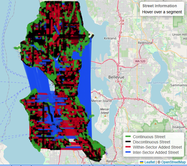
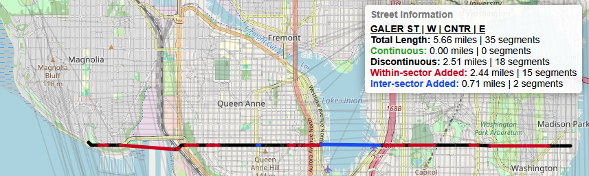
In the image above, the blue lines are the cross-sector connections and the red lines are the within-sector connections. The connections across the various salt and fresh water bodies really stand out and emphasize the quasi-grid structure as seen in Seattle’s streets. That being said, Galer is probably a little hard to see in that image, so here it is by itself.
Version 2.0 of this project also features outlines of the various city sectors. The city sectors were created based on the street direction prefix and suffix.When hovering on a segment, all other segments are made transparent and the city sectors can been.
The minor bump to version 2.1 features modest tweaks to the control flow and a great deal of added documention. The project’s README.md describes the process and the output in great detail. There are also histograms of the different types of added segments. I’ll include some highlights about the added within-sector segments (red) and cross-sector (blue) segments below:
-
2,453 uniquely named roads in the study area 1,890 road miles: see these graphics for a comparison of miles and road segments - 1,145 roads without discontinuities - 312 road miles
- 1,308 roads with discontinuities - 1,578 road miles
- 3,617 within-sector segments added across 1,103 roads - 833 miles
- 410 cross-sector segments added across 313 roads - 24 miles
- Average of ~3.3 within-sector segments added per uniquely named road
- Average of ~1.3 cross-sector segments added per uniquely named road
- Average added within-sector segment length: ~0.23 Miles
- Average added cross-sector segment length: ~2.0 Miles
- Median added within-sector segment length: ~448 Feet
- Median added cross-sector segment length: ~1.1 Miles
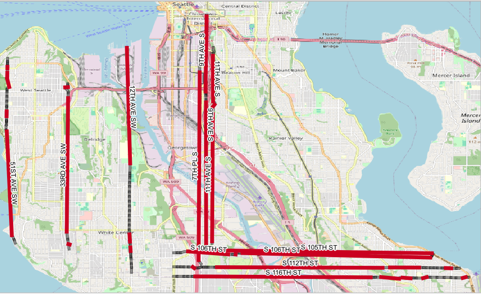
- Greatest number of within-sector segments added: 14 1ST AVE NW
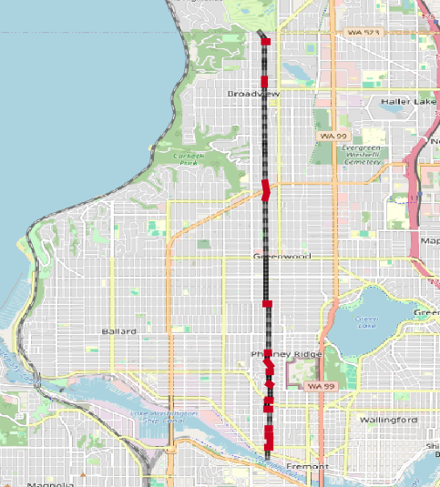
- Longest within-sector segment: ~5 Miles: 7TH PL S (10 longest added segments)
- Shortest within-sector segment: ~4 Feet: SW CLOVERDALE ST
Known issues and errata
The goal of this project is to identify the discontinuities in streets is Seattle. A discontinuity presents differently depending on the mode of transporation in question: streets are a lot more accessible to pedestrians and bicycles than a car. A good way to think about these discontinuities is how they would appear as if navigating Seattle roadways in a vehicle. Accordingly, a component of the initial data processing involved removing the following road types: alleys, trails overpasses, interstates, state routes, rail, flyovers, streetcars, extensions, turns, highway ramps, and walkways. Some of these roads are not accessible by vehicle. And some of these roads are few in number and short in distance. Expect, of course, for the interstates and state routes. But those are largely continuous (and not that interesting for this project).
As is often the case with geospatial data, there are minor discrepancies between data sources pertaining to the same area. The webmap is from OpenStreetMap and the street network data is from the City of Seattle. Far more often than not, the data align geospatially. However, sometimes the data do not align. These instances are rare and often the degree of misalignment is small. A solution is to use only data from OpenStreetMap. Perhaps for v3.0 I’ll use data from OpenStreetMap.
For both v1.0 and especially v2.0, the connectivity is somewhat arbitrary. The rules for within-sector connectivity are based on street name, type, and direction prefix/suffix. This leads to a specific, straightforward connectivity logic. For cross-sector connectivity, only street name and type were considered. While this has created some odd connectivities, I tried to be internally consistent and line up the various cross-sector connectivities based on a quasi-grid structure. Finally, if anything looks execptionally out of place or you have additional questions, please let me know. I am happy to address issues and provide additional clarifying information.