Visualizing Street Discontinuities: v2.0
I just updated my project on identifying and visualizing Seattle’s discontinuous street network. See this page for version 1.0.
SEE THIS PAGE FOR AN INTERACTIVE MAP OF THE ADDED STREETS
The major change in version 2.0 is that I added the connections between city sectors. For example, there are now connections between W GALER ST and GALER ST and connections between GALER ST and E GALER ST.
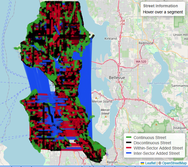
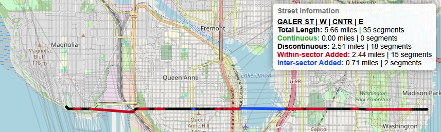
In the image above, the blue lines are the connections between sectors. The connections across the various salt and fresh water bodies really stands out and really emphasize the quasi-grid structure as seen in Seattle’s streets. That being said, Galer is probably a little hard to see in that image, so here it is by itself.
I’ll update this post with more information about how I created the interconnections and some of the others features in version 2.0. But for now, I am going to finish this beer at The Sloop, commit some code and these words, and make my way home.